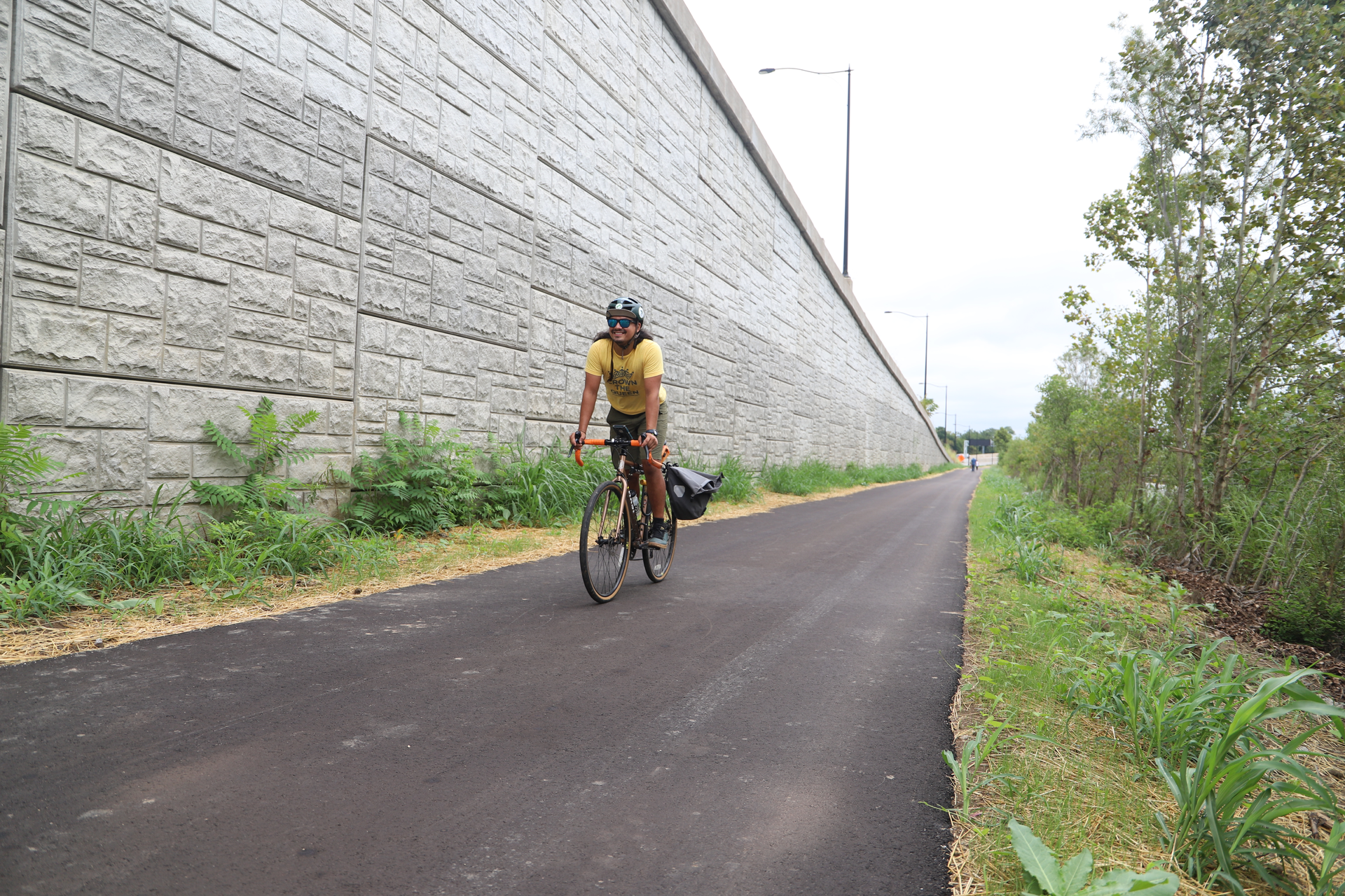
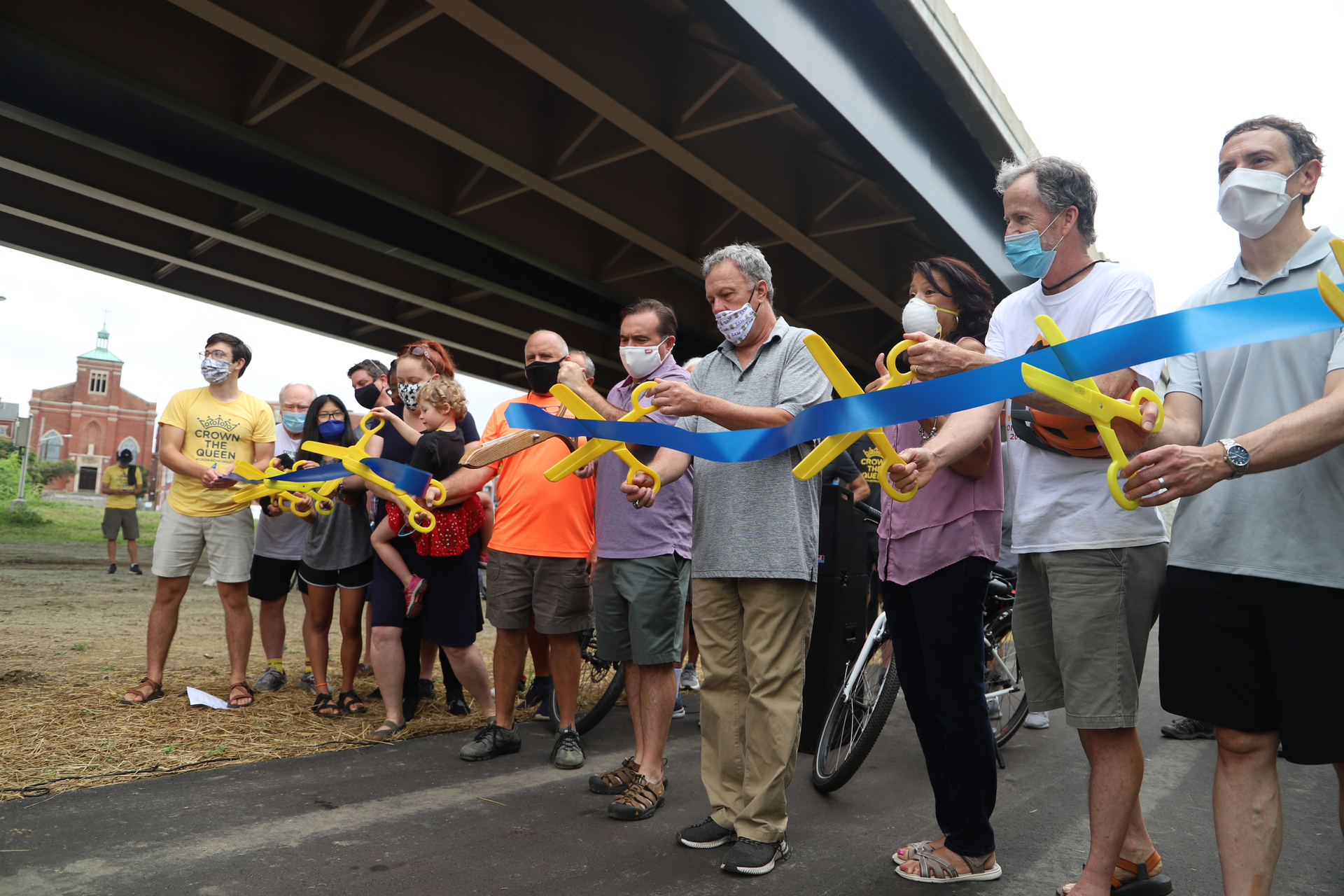
Neighborhood leaders, nonprofit groups and Cincinnati elected officials Saturday unveiled a .6 mile stretch of bike and walking path on the southern edge of Lower Price Hill.
That swath of pavement, part of the planned Ohio River West Trail, could someday allow Price Hill residents to ride the roughly two and a half miles downtown in a matter of minutes — a key, non-automotive link between the West Side and the city's core, Cincinnati Mayor John Cranley says.
The path between Evans Street and State Avenue is also part of more ambitious plans. Supporters hope that, over the next decade, the Ohio River West Trail will eventually stretch 26 miles all the way to Shawnee Lookout Park, which sits on Ohio's border with Indiana. And more progress to the east could take riders all the way to the Loveland Bike Trail someday.
The short path is also a key link in a proposed 34-mile network of paths and lanes connecting Cincinnati called CROWN, or Cincinnati Riding Or Walking Network.
Nonprofit trail advocacy group Tri-State Trails has been instrumental in envisioning and promoting CROWN. Director Wade Johnston says the path is a key part of that much larger plan.
"It's a part of a bigger vision," Johnston says. "Last year, the city opened a four-tenths of a mile segment at Gilday-Riverside Park, and the city just got started on another piece that will come east from Gilday to Fairbanks Avenue."
That 1.3 mile section, which runs to Sedamsville, is already underway.
"We're working to connect those two segments and connect this trail to downtown," Johnston said. "We're (also) trying to a create 34-mile trail loop around the city that will link up the Ohio River Trail, the Wasson Way Trail, the Mill Creek Trail and the Little Miami Trail."
CROWN could create myriad new mobility options, boosters say, especially in neighborhoods that don't have high levels of car ownership.
Despite the progress on that trail and others like Wasson Way, frustration remains among some bike supporters, mostly around the slow pace of bike infrastructure improvement and the lack of bike lanes in the city.
In 2010, Cincinnati City Council passed a citywide,15-year bike plan that called for 350 miles of bike lanes around the city. But Mayor John Cranley, who took office in 2013, much prefers bike trails, and the city's administration has generally prioritized the latter. Thus, only a tiny fraction of those 350 miles of lanes have been completed.
The city applied for federal grants to fund the Lower Price Hill bike path in 2014, and just completed the project this month.
The debate about the pace and trajectory of Cincinnati's bike infrastructure hasn't gone away. Department of Transportation and Engineering Interim Director John Brazina last year presented an update on the city's bike program. That update calls for completion of more paths and trails, but also highlights the funding challenges inherent in installing the more expensive off-street infrastructure, which can cost between $1 million and $3 million a mile.
On-street bike lanes are much cheaper, supporters say — about $2,000 a mile. They cost even less when roads are already being repaved by the city. Further, bike lanes are vital in some parts of the city that aren't well-served by bike paths but need better accessibility options, according to lane advocates. Those lanes can help bike commuters who may live in lower-income areas and may not have cars get to work, for example.
Cranley has said bike paths or trails are safer, as they're not on the streets, and allow for a diversity of uses.
Despite the debate, neighborhood leaders in Lower Price Hill say they're excited about their new bike path.
Lower Price Hill Community Council President Cynthia Ford said she was initially taken aback by coverage describing how short the path is.
"The more I thought about it, I realized that every good thing has to start somewhere," she said. "And what better place than Lower Price Hill?"
Ford says the path will complement community development efforts in the neighborhood, including a new affordable housing initiative called Price Hill Thrives and a nonprofit grocery store currently in the works.
"It's absolutely perfect that the Ohio River Trail West should launch here in Lower Price Hill," she said.