According to the Environmental Protection Agency, the average American spends 87 percent of their life indoors and another 6 percent in cars. That means humans are only outside for roughly 7 percent of their lives — a disheartening statistic.
But you can buck that trend: Greater Cincinnati is home to myriad free parks with their own unique vibe.
And, if you need another reason to step outside, the outdoors increases serotonin levels and gives your immune system a boost — it’s a natural energizer. Got a dog? Walk it. Have kids? Tire them out. An old friend? Reconnect with them. Or, go Walden-style and wander alone to your heart’s content.
This handy guide of local parks is just a sampling of where you can go in the Queen City for an outdoor outlet, with a specific focus on hiking trails achievable for any fitness level (a few are even paved for strollers and wheelchairs).
The Parks
North
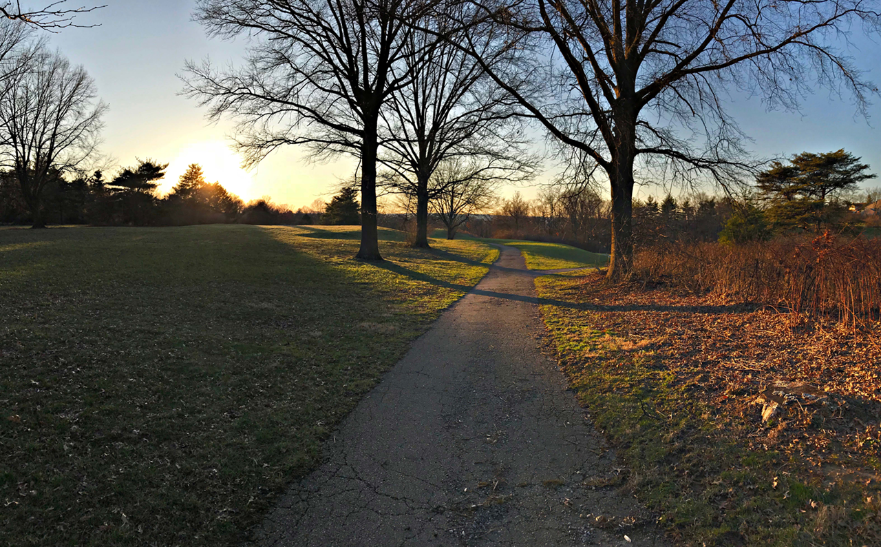
French Park
3012 Section Road, Amberley Village, cincinnatiparks.com
Features: Intermediate hiking, ample parking, gravel paths only
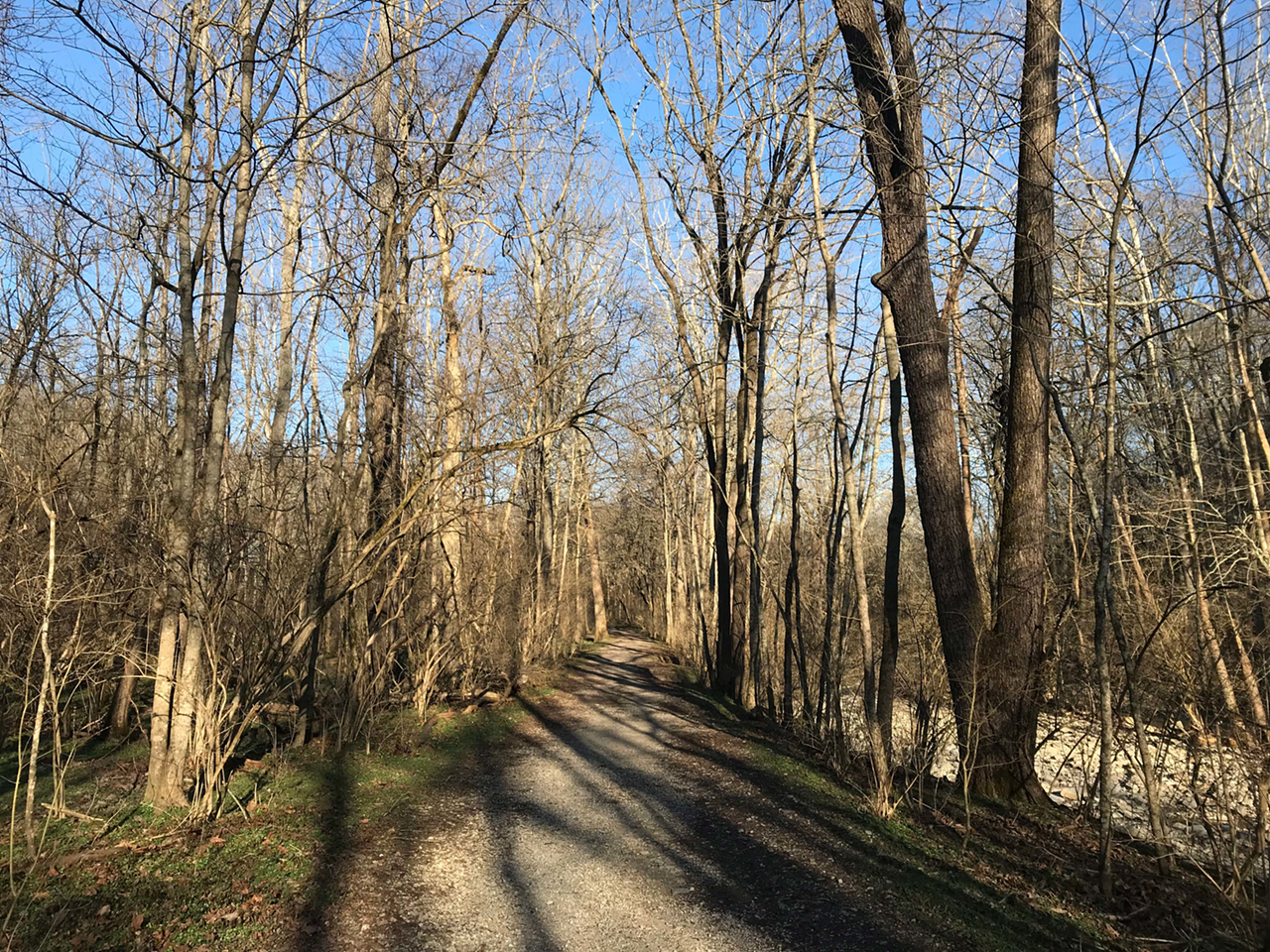
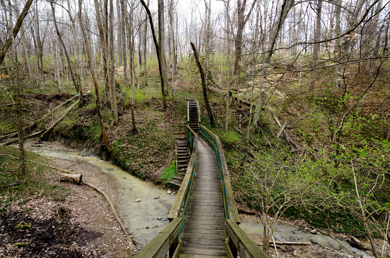
In French Park, pockets of grassy knolls lay hidden in the woods, and a large stream moseys behind the French House, a 1900s brick mansion perched royally on the hill. Second in size only to Mount Airy Forest, it is considered by many to be the city’s — and Cincinnati Park’s — best-kept secret. Considering its massive 275-acre size, you’d expect more hikers to busy the trails, but a jaunt here is frequently a quiet venture.
“The whole ambiance of the park is majestic,” says Ruthann Spears, manager of Explore Nature programs at Cincinnati Parks, “especially having that French House up on the hill. French Park has an active stream, meadow trails and my favorite part about it are the fossils you can discover in the creek.”
The park features a web of trails tucked behind French House with four trailheads visible from the main parking lot. The outermost loop, plush with green grass, is about 3-miles long. The inner stream trails are made up of dirt, gravel and bridgeways. These hikes are decidedly hilly and intermediate and not for the faint of heart.
Fun fact: The grave of the beloved dog of French Park’s original owner, Procter & Gamble executive Herbert Greer French, can still be seen near one of the backwoods trails.
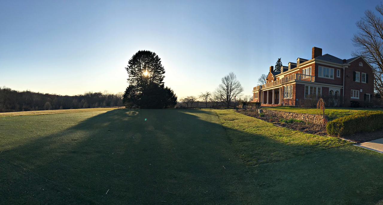
Amberley Green
7801 Ridge Road, Amberley Village, amberleyvillage.org
Features: Easy hiking, ample parking, paved paths only
Amberley Green neighbors French Park. Bordered by Ridge and East Galbraith roads, traffic noise is a given but the space is peaceful nonetheless.
It’s a surprising 133-acre plot of land: formerly Crest Hills Country Club and golf course, it was converted to a park in 2007. A handful of ancient pine trees and stoic oaks surround the pond situated in the center of the park. Otherwise, the Green is not wooded.
It has a perfectly rectangular shape, plus some obvious fairways, which make plain that this was once a grand course. Former cart paths now serve as leisurely walking and jogging trails. Baby strollers and senior patrons have an easy time here because the cart paths are never busy. There are two trail loops; the outer is little less than 2-miles long, and the inner is about 1 mile.
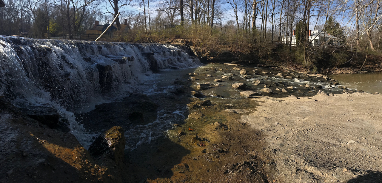
Sharon Woods
11450 Lebanon Road, Sharonville, greatparks.org
Features: Easy hiking, ample parking, gravel paths and paved paths
Sharon Woods, established 1932, is the oldest park in the Great Parks of Hamilton County network. Within its 730 acres are trails, a lake, a boathouse, pavilions, playgrounds, a golf course and Heritage Village, a “living museum” that recreates what Ohio life was like in the 1800s.
Kimberly Whitton, Great Parks public engagement coordinator, says one of the paths — the 0.7-mile “Gorge Trail” — is a state-dedicated nature preserve “with waterfalls and deep gorges.” While the trail is relatively level, there’s a slight ascension if you start near Buckeye Falls, a destination for photographers, and end at Sharon Lake. The path is wide, well-maintained and ideal for running or beginner-level hiking. Hiking boots are not necessary. The path passes by the expansive golf course.
“It’s one of my favorite trails. It’s short and sweet,” says Whitton.
Otherwise, there are two paved trails: the Shared Use trail, a 2.6-mile loop around Sharon Lake, and the 1-mile Parcours Trail, also known as the Fitness Trail, which features workout stations.
The park is part of the Great Parks Hiking Staff Program. If you hike seven different trails annually, you’re eligible to buy a wood hiking staff for $3 after the first year, and a $2 metal emblem (to attach to the staff) every subsequent year.
Note: This park requires a parking fee of $3 for Hamilton Country residents and $5 for non-residents.
East
Red Bird Hollow
6168 Given Road, Indian Hill
Features: Easy hiking, minimal parking, gravel paths only
On the edge of Terrace Park sits Indian Hill’s Red Bird Hollow, a narrow, 3-mile-long gravel trail with a stream running alongside it. The path is simple: You come out the same way you went in. When the trees are in full bloom, the Hollow looks like a labyrinth — sun rays can’t penetrate through the leaves and there are minimal sounds other than a trickling stream and chirping birds.
The trail, while secluded and quiet, requires you to wave hello to passersby a fair amount, and the occasional couple walking by is almost always joined by a well-mannered dog. One of those couples? Roseann and Riley Hayes of Terrace Park, who walk their pooches at Red Bird Hollow daily. “This is more of an every-day I-go-to-Red-Bird-Hollow kind of thing,” says Roseann. “It’s pretty and accessible and close to Terrace Park.”
West
Mount Airy Forest
5083 Colerain Ave., Westwood, cincinnatiparks.com
Features: Intermediate hiking, ample parking, gravel paths and paved paths
“Mount Airy is the heart and soul of hiking for Cincinnati Parks because it has so many trails,” says Explore Nature’s Spears. “It’s a historical, man-made forest that can only evoke gravitas.”
One of the few African-American Civilian Conservation Corps in Ohio was employed to plant over one million trees in Mount Airy. They lined the trails with stones and built dams, picnic shelters and more. The Corps restored this vast farmland that had gone bad due to improper tilling to the National Historic Site it is today.
Red Oak Trail is 1 mile long and is the primary artery cutting through the western woods of the park. Many other trails stem from Red Oak, namely Ponderosa, a 3-mile trail, and Beechwood, a 1.3-mile trail. Runners often compile the Beechwood, Quarry and Red Oak Trails into a 7.5-mile jogging loop. All are considered intermediate.
Want a challenge? The Stone Steps is a strenuous 90-stair uphill climb that runners often tackle.
For an easier alternative, there’s the 1.75-mile Treehouse Trail, which starts at Everybody’s Treehouse, the park’s wheelchair-accessible hidden gem wooden treehouse. Although Mount Airy Forest’s trails are numerous, all of them delve deep into a forest of woods and wildlife. The sheer size — a whopping 1,500 acres — is breathtaking. Both standing and fallen trees span for miles and miles, accompanied by a bed of shimmering, silver-gold leaves leftover from winter.
“Mount Airy is a big part of Cincinnati,” says Spears. “So many people have fond, family memories of it. And today it’s still used in the same way.”
Central
Ault Park
5090 Observatory Ave., Mount Lookout, cincinnatiparks.com
Features: Intermediate hiking, ample parking, gravel paths and paved paths
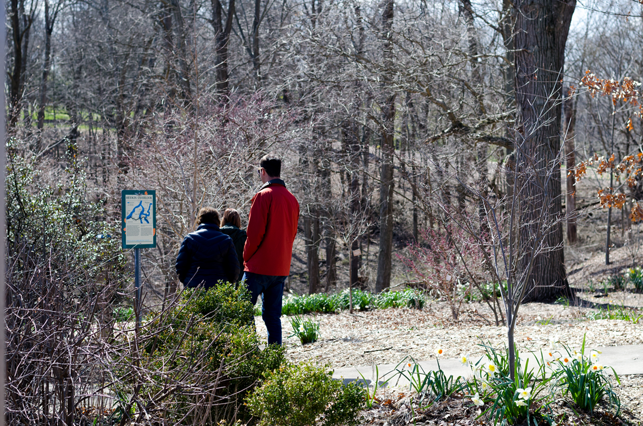
Ault Park is nestled within an unsuspecting nook of Mount Lookout. Here, the suburban rush slows to a lull.
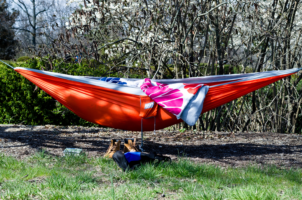
Hiking loops orbit the park’s signature palisade, which doubles as an overlook and event space. In front of the palisade are well-maintained gardens, marking it as an ideal spot for engagement and family photos. Between the gardens lie open fields where visitors can kick a soccer ball, toss a Frisbee or hang hammocks on nearby trees.
In the summer, there are beer and wine tasting events, free yoga classes, drumming concerts and firework displays. On higher ground, where Heekin meets Principio Avenue, there’s a playground very popular among kids.
From early morning until late afternoon, the sprawling landscape is full of people traversing its paved loops and gravel trails. If the park were smaller than its boastful 224 acres, it may feel crowded.
Hiking boots and a stick serve as the best equipment for the trails. The mud and tree roots can be tricky for ascension (and great fun for kids). There are at least nine trails, but the two most notable loops are the Perimeter Trail (a compilation of four smaller trails) and Ridge Trail.
Perimeter Trail is just the amendment of Shattuc Trail, Cliff Trail and a small portion of Forest Loop Trail, finishing on the wide and flat Valley Trail — at 3 miles, it the widest loop in the park. Ridge Trail is a little more than 1-mile long. It branches off of Valley Trail and later reattaches.
South
Tower Park
900 S. Fort Thomas Ave., Fort Thomas, ftthomas.org
Features: Intermediate hiking, ample parking, gravel paths and paved paths
Tower Park, located in Fort Thomas, is remarkably multifaceted for only 87 acres. There’s a baseball field, a sand volleyball court, tennis courts, basketball courts, an indoor pool, a track and a pristine playground near the front entrance. Plus, an amphitheater for concerts, a military museum, a reserve center, a retirement community and a veteran’s medical clinic.
It’s rife with military history. Plaques with names of the deceased decorate every bench, tree and structure. Ten Army homes, originally built in the 1890s, stand in the Alexander Circle cul-de-sac. For the last 15 years they’ve been empty, and though they stand in disarray, they’re striking nonetheless.
Tower Park wears its history on its sleeve, with trails that are relatively steep and intermediate. Most patrons enjoy the paved walking loop around the baseball field and Mess Hall.
There are many narrow offshoots from the main Amphitheater Road trail. A major stream runs parallel to the popular Landmark Tree trail, which bends and borders the Ohio River for a mile and a half before looping back to the baseball field where it started.
More Tempting Trails
Big Bone Lick: If you’re up for a short drive, Big Bone Lick State Park in Union, Ky. has a collection of easy and moderate trails that pass through the historic site’s woodlands, grasslands, savanna and salt-sulfur springs. Named after the Ice Age Megafauna that once occupied the area and its saltwater streams, the park is still home to a collection of giant mammals: bison. The 10 to 15 on view are a link to the Ice Age and an attempt to reestablish a herd of the endangered animals at the park. More info at parks.ky.gov.
Caldwell Nature Preserve: Ranked as one of the top 10 hikes in Ohio by Marmot outdoors company in 2016, Caldwell Nature Preserve in Carthage has 3.5 miles of trails that include a paved and level path into the woods that is accessible to those in wheelchairs. More info at cincinnatiparks.com.
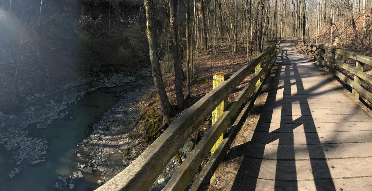
Cincinnati Nature Center: Located in Milford, the Cincinnati Nature Center’s Rowe Woods has more than 16 miles of hiking trails through Eastern deciduous forest. Trails range from easy to difficult. Easy means the trail is comparatively flat, less than 1.25 miles long, is at least 3-feet wide and features stream crossings with bridges. Things amp up in moderate and difficult trails, which feature elevation changes, remote locations and harder stream crossings. The Center’s Hike for Your Health program features a passport you can pick up at the visitor’s center. After completing and getting a stamp for all 15 trails at Rowe Woods and sister facility Long Branch Farm in Goshen, you get a special prize. More info at cincynature.org.
go Vibrant Walking Tours: If an urban landscape is more up your alley, check out go Vibrant’s collection of walking routes through city neighborhoods like East Walnut Hills, Madisonville, Mount Adams and Northside. Signs mark the routes, generally between 1 and 5 miles long, through each neighborhood and wind walkers and runners past business districts, historic homes, urban parks and hidden nature trails. New routes are coming soon to Clifton, Mount Washington and Newport. More info and maps at govibrant.org.