A c
ouple of years ago I was heading up William Howard Taft Road to Gilbert Avenue and was nearing the intersection in the left turn lane when a contractor’s van started tailgating me. The driver whaled on his horn for me to move. Now, seriously, this guy had a gas pedal and could go much faster than me. There was no reason in the world that he couldn’t have jumped in front of me and gone on his way. Instead, he wanted to give me a hard time on my commute. So I yelled at him to go around me. He did and then cut his van diagonally across the lane, threw it into park and started to get out. I wondered if he had a weapon, and my left hand reached for my U-lock.
He cursed at me and I considered my options: If I get off the bike, it’s on, but I don’t want to be punked, either. I opted for a middle road — cursed back at him and kept riding slowly around him. I lost him on the Gilbert Avenue downhill even though I wasn’t riding that fast. A gentleman walks but doesn’t run.
I relate this story not because I was some sort of two-wheeled hero for moving on — in fact, I was almost a willing participant in road rage — but because it’s common to tangle with drivers when you ride in the street. Sometimes it’s because you’re riding like a jerk. Mostly, it’s because they don’t think bikes belong on the roads. And even when you have nice drivers around you, and you’re wearing your helmet and a neon green shirt, the truth is that you’re little and hard to see when compared to even a compact car.
Riding on city streets is exhilarating and makes you feel at one with the city — seeing, smelling and hearing things you’d never experience in a metal box. It’s also taxing and a tiresome game of checking and rechecking your mirror, looking over your shoulders and being solidly on the defensive. Trails, though rarely practical for commutes, offer a freedom that you can’t find on the crowded road.
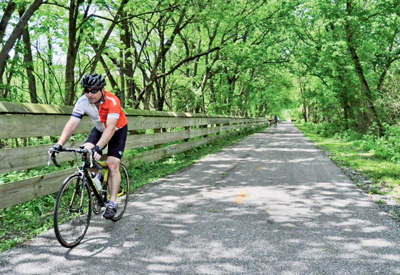
Cheryl Crowe, a local cyclist who’s a board member with Queen City Bike, says she regularly rides the Little Miami Scenic Trail (LMST) for recreation. This is what most people mean when they say, “Loveland Trail.” It’s the 78-mile, southern-most segment of the Ohio to Erie Trail, which runs from Cleveland to Cincinnati. The LMST is a paved trail that replaced old train tracks and runs from Springfield to Newtown. It has easy-to-climb grades, is partially canopied by trees during warm months and is the longest and most popular trail in the city.
“I anticipate the expansion of the trail along the river,” Crowe says. “It would be nice to tie the entire span from Anderson to Downtown together. I covet the construction of Wasson Way. If that trail should go in, then I could ride to the store with very little time spent on streets. It would stretch east to meet up with the Little Miami Trail and west to Xavier.”
Nate Wessel is another local bike enthusiast who wishes there were more local trails that could be used by commuters. Wessel designed the handy, pocket-sized Cincinnati Transit Map that’s been making the rounds. As it is, our three local trails are all construction projects in various stages of completion. The Ohio River Trail has a couple of miles complete out of a projected 23-mile route from Coney Island to Saylor Park; a small part of the Mill Creek Greenway Trail (planned to be 13.5 miles) can be explored from a trailhead on Spring Grove Avenue in Cumminsville; and the Little Miami Trail, which technically ends in Newtown, has a handful of paved segments between Newtown and Downtown, the longest stretch at Lunken Airfield. Besides these piecemeal urban trails, there are closed loops in local parks and shared paths in Blue Ash that are essentially wide sidewalks.
“I would love to see an expansion of urban trails in places that make sense for people who are trying to get somewhere, even if it’s a little circuitous,” Wessel says. “For example, there is an abandoned rail right-of-way along the Mill Creek between Northside and South Fairmount that seems to be used as an access road by the sewer district. It has some wonderful views of Downtown, the hills and the rail switchyard. Plus, it could serve as a car-free alternate route from Northside and other nearby neighborhoods to the West Side or Downtown. I actually ride it all the time despite the fact that it’s chained off and paved with very course gravel.”
Roll-your-own trails are pretty common. Most cyclists delight in finding secret, quiet routes in the city. Wessel notes a short, hilly trail in Northside that connects a couple of local streets, which he goes out of his way to use because it goes through older-growth woods with large trees and nice views.
“I’d like to see trails like that but on a larger scale,” Wessel says, “perhaps something connecting Northside to College Hill through Mount Airy. … I would like to see trails not so much as recreation in and of themselves, but as a beautiful and relaxing way to get to places I might want to go, even if I don’t go there often. I’ll go out of my way for a trail, but I usually don’t leave the house just to ride on one.”
©
